An array of instruments that can be used individually or in combination to address a wide range of research questions has been assembled at the Baruch Marine Field Laboratory (BMFL). These instruments can reveal fine scale patterns of temperature, plant pigments, soil types, and many other features on the surfaces of marshes, creeks, forests, and beaches. For example, locations of groundwater seepage can be spotted by differences in temperature patterns of moist soils across a marsh landscape. Areas of high or low plant productivity can be determined by cameras that record wavelengths of light reflectance or absorption across a marsh or agricultural crop field. Data extracted from these images can be analyzed using specially designed software which can quantify and display other ecosystem properties.
Instruments and Capabilities
High-resolution acoustic imaging sonars transmit sound pulses underwater and convert the returning echoes into high-resolution digital images, much like a medical ultrasound sonogram. Thus, acoustic imaging sonars can “see” in zero visibility aquatic conditions, making it possible to track motile organisms and delineate underwater structures. Unhindered by the turbid waters of estuarine and coastal environments, acoustic imaging can operate at various temporal and spatial scales both day and night, with minimal or no disturbance to animals or habitats, and at much reduced labor intensity (e.g., 1 person). Together these attributes provide unmatched and powerful observational and experimental research opportunities.
BMFL has an ARIS Explorer 3000 with a maximum resolution of 3.0 MHz, an AR2 Rotator that permits the sonar to rotate a full 360° and includes multiple pan and tilt options. The sonar equipment can be operated manually or set to run specified sampling regimes autonomously using ARIScope software. Imaging data can be analyzed using ARISFish software, which allows for customizing analytical protocols and tracking of individual targets. More information is available on the sonar equipment and software from the manufacturer, Sound Metrics, Inc.
Rates and policies for use of the sonar equipment can be found here.
Our camera is a Sony HDRPJ260V high definition Handycam 8.9 megapixel camcorder. This is a lightweight off-the-shelf camera with digital zoom (30x optical/ 55x extended), wide angle G lens, low-light sensor, and image stabilization. It also has a built-in GPS receiver that can be used to tag images. High capacity battery and memory provide for extended use in the field. Used in combination with other instruments and the TLS which do not record in the visible light spectrum, the video acquired by this camera provides images that are useful for interpret ting data and characterizing other features of the landscape.
Multispectral cameras produce images at specific frequencies across the electromagnetic spectrum, within and beyond the visible light range. See the diagram of a light spectrum. Filters are used to collect data at different ranges of wavelengths. Multispectral cameras have many applications in ecosystem, forestry, geological, and agricultural research. Analysis of the combination of multi-spectral images enables investigators to identify areas of plant condition and stress, differentiate plant species and soil types, or recognize other properties that can be identified by their unique spectral signature.
The multispectral camera at BMFL was manufactured by Tetracam Inc. It is a model TTC1021- MINI MCA with six channels, each with a 9.6 mm lens. Each of the six cameras is fitted with a different standard bandpass filter which allows different sets of visible or near infrared radiation to move through each camera’s lens to form separate images on the camera’s sensor. Those images are transferred to a memory card. More information can be found on the Tretracam Website.
A spectrometer, also known as a spectrophotometer or spectroscope, measures light intensity over a specific range of the light spectrum. An internal grating separates an incoming light ray into a frequency spectrum and this information can be used to determine the relative amounts of light of certain wavelengths. A spectrometer can be used to determine the characteristics of light reflected from surfaces. That information can be used in combination with visible light imagery to quantify light reflectance or absorbance by plants and algae in an area. Over a salt marsh, this information could be used to map distributions and estimate photosynthetic activity.
The BMFL instrument is an Ocean Optics JAZ Spectrometer System (JAZ –DPU-GPIO) which operates in the 250-800 nanometer (nm) range, with best sensitivity around 650 nm. It captures data between the ultraviolet and near infrared ends of the light spectrum. The JAZ has an interchangeable lenses (50, 100, and 200 microns), a 600 micron filter, a cosine corrector and a collimating lens (20-2000 nm) for long distances.
This instrument, also known as ground-based LIDAR, measures distance by illuminating structure with a laser beam and analyzing the reflected light. The laser beam is very narrow and can map physical features with very high resolution (e.g. millimeters). The head of the instrument moves during the image making process and creates a three-dimensional image. When mounted on a surveyor’s tripod and aimed across a landscape, the instrument can generate a detailed map of topography and geomorphology of the area. When mounted with the head pointed downward over a marsh, information on plant density, composition, height distribution, and other information can be captured and analyzed.
The BMFL instrument is a Leica ScanStation P20 Laser Scanning System. This ultra high speed scanner is capable millimeter- scale resolution and a range (radius) up to 100 m. Specifications and other details of the P20 scanner.
Thermal or infrared (IR) cameras detect infrared radiation intensity emitted by heated material. Cameras deliver images in which differences in colors and intensity indicate differences in temperature. Application of IR images for ecosystem research includes the determination of temperature gradients and heat anomalies within an area. Time-sequenced images may reveal rates of change over daily cycles, tidal cycles or seasons, or movements of animals. Infrared images can provide information on plant stress or movements of animals.
The infrared camera system that is available at BMFL was constructed by ICI (Infrared Camera, Inc.). It is a model number 9640 camera with a: 25 mm lens, 640 x 480 UFPA VOX microbolometer detector, spectral response of 8 to 12 microns, accuracy of 2℃ or (2%)and thermal sensitivity of 0.03℃. This camera was fitted with a 3-axis gimble and a 2.6 GHZ wireless system so that the camera can be remotely operated when deployed.
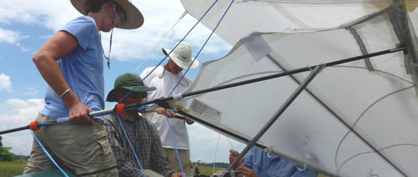
Find out more about instrument deployment options.
Funding for the instruments came from the National Science Foundation's Field Station and Marine Laboratory Program. The intent of the grant was to enable the BMFL to create new research and education opportunities for visiting and resident scientists and educators.