Class of 2026
As the Class of 2026 prepares to walk across the commencement stage, graduates leave the University of South Carolina with memories of enduring friendships, newfound passions, supportive mentors and life-changing experiences.
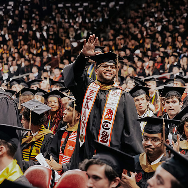
As the Class of 2026 prepares to walk across the commencement stage, graduates leave the University of South Carolina with memories of enduring friendships, newfound passions, supportive mentors and life-changing experiences.

Thousands of graduates from across the University of South Carolina will celebrate May commencement ceremonies beginning Thursday, May 7. USC President Michael Amiridis will deliver remarks at all four baccalaureate ceremonies taking place at the Colonial Life Arena (schedule below). Separate ceremonies also will be held for the Joseph F. Rice School of Law, the two Schools of Medicine and the doctoral graduates.

Dawn Staley has been elected to the American Academy of Arts and Sciences. Election to the Academy is a prestigious honor, and Coach Staley joins only three others from USC who are currently part of the academy. Founded in 1780, the American Academy of Arts and Sciences is both an honorary society that recognizes and celebrates the excellence of its members and an independent research center convening leaders from across disciplines, professions and perspectives to address significant challenges.

USC marked a major milestone in providing specialized cognitive care at a ribbon cutting for its Brain Health Center on the Health Sciences Campus on Wednesday. The facility is designed to deliver exceptional diagnostic, treatment and support for patients living with cognitive conditions, including Alzheimer’s disease and related dementias.

Five University of South Carolina students earned the prestigious Goldwater Scholarship in 2026. This sets a record for the most Goldwater Scholars at USC in a single year and marks the 34th consecutive year the university has had at least one Goldwater Scholar.
(feat. Geoffrey Alpert, criminology and criminal justice) South Florida Sun Sentinel via Yahoo! News
(feat. Nicholas Watanabe, sport and entertainment management) WACH FOX 57
(feat. Adel Nasiri, electrical engineering) WLTX News 19

This spring, doctoral graduate Zo Sediqi will walk across the stage to receive her diploma from USC’s College of Education. As a woman born and raised in Afghanistan in the 1990s, the moment carries special significance: Sediqi is one of only a handful of Afghan women anywhere in the world to earn a Ph.D.

A decades-long fascination with life has inspired Rachel Kiser, one of two Algernon Sydney Sullivan Awards recipients, to dedicate her career to improving drug treatments for diseases.

Leadership and service is at the heart of everything Santiago Avendaño Palacio, one of two Algernon Sydney Sullivan Award recipients, does.

Blood clots in the lungs are a leading cause of cardiovascular-related deaths. But what if gene editing, made possible through ultra-small nanoparticles, could effectively treat clot-induced tissue damage? For USC School of Medicine Columbia scientist Colin Evans, the question is no longer hypothetical.